
El Mirage ZIP Coverage
Official sources support 85335 as the sole El Mirage-named standard ZIP. It serves the incorporated core and a wider delivery area. That distinction matters because a postal label is not a city boundary. Nearby 85351 and 85363 serve Sun City and Youngtown areas near the municipal edge, while Surprise also borders the wider West Valley setting. An address near those edges needs individual review rather than a guess based on the city name printed in mail.
| ZIP Code | Areas Covered | Post Office | Notes |
|---|---|---|---|
| 85335 | El Mirage incorporated core and surrounding delivery area | El Mirage Post Office, 11925 W Thunderbird Road | Standard ZIP; not PO-box-only or unique |
The El Mirage Post Office also supports PO-box access and General Delivery. A carrier annex operates at 12375 W Alice Avenue, Suite 1, but it does not create a second El Mirage ZIP. The ZIP code directory therefore has one main row, not several padded rows for nearby postal zones. USPS remains the authority for the mailing form, while county GIS decides where the parcel lies.
The USPS El Mirage Post Office record shows the local facility, phone number, and retail services.
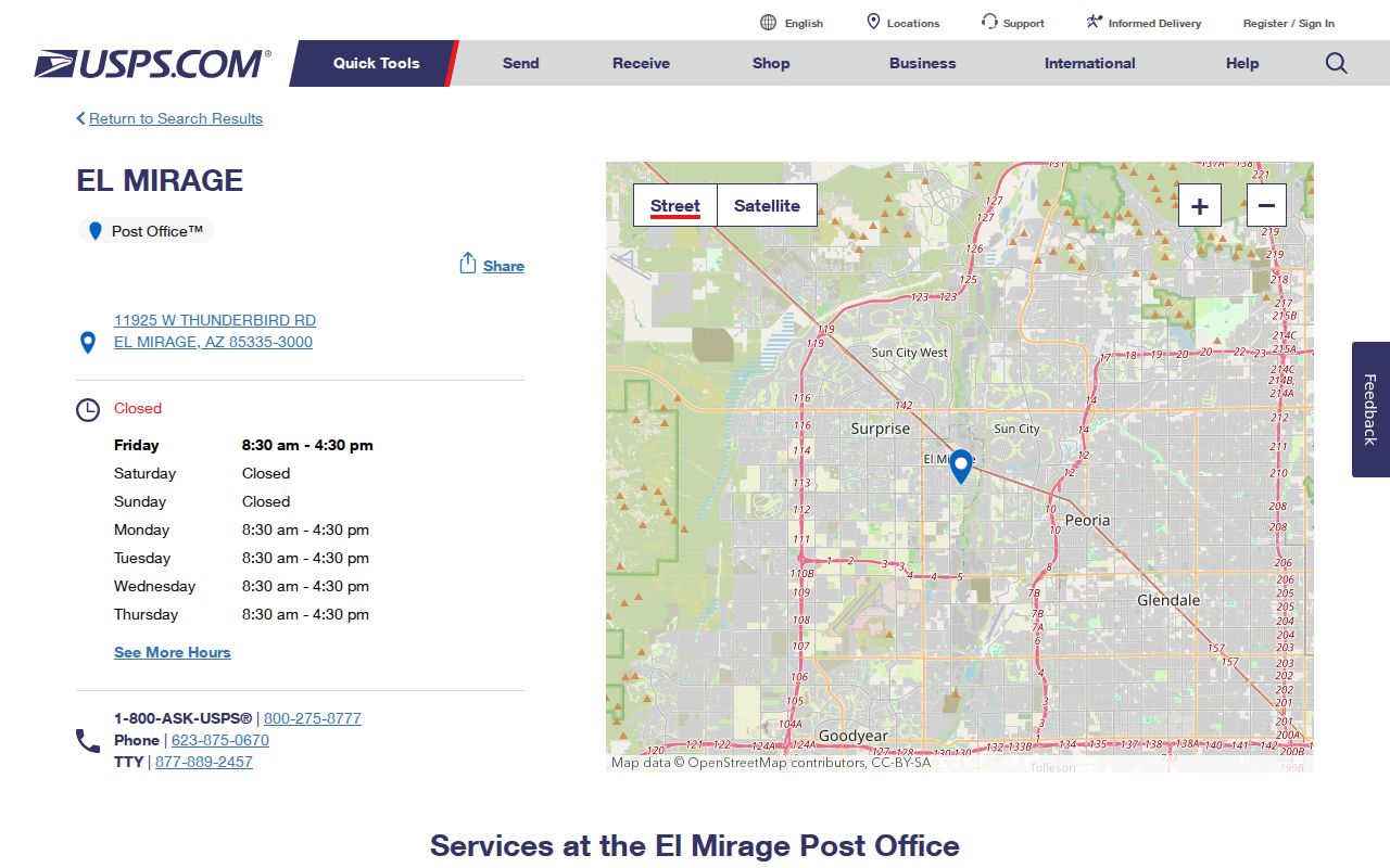
The facility record anchors 85335 to an official postal source without treating its delivery territory as the El Mirage city line.
Verify El Mirage ZIP Records
Begin with the USPS ZIP Code Lookup. Use an exact street number and street name. The result supplies the standardized postal city and ZIP, which should be saved as the mailing form of the address. It does not decide whether city permits, code records, or municipal services apply. Those questions turn on jurisdiction.
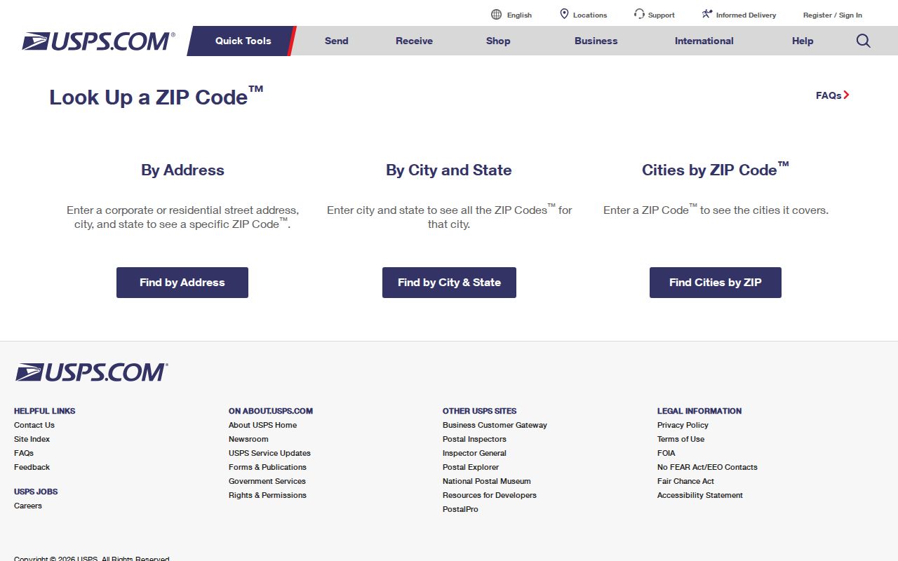
The USPS form is the clean first step because spelling, suffix, and delivery details can affect later address matches. Once it returns 85335, test the same address in the county property tools.
- Enter the full address in USPS and keep the standardized result.
- Open the Assessor and match the situs address, which means the physical parcel location.
- Open Parcel Viewer to inspect the city, subdivision, and surrounding parcel context.
- Use El Mirage permit records only after the parcel is shown inside municipal jurisdiction.
Once a ZIP narrows the area, the El Mirage street directory handles the finer address and deed trail. The ZIP code directory should not be mistaken for a list of everyone on each street.
Search El Mirage Records by ZIP
The Maricopa County Assessor property search accepts a city or ZIP in its main search. It can return parcels tied to 85335, then expose the APN, owner line, separate owner mailing address, situs address, subdivision, valuation facts, and related links. APN means assessor parcel number. This result is an ownership roll, not proof of who sleeps at the address.
The Assessor's official search help documents city and ZIP input alongside parcel, owner, address, subdivision, MCR, business account, and mobile-home identifiers.
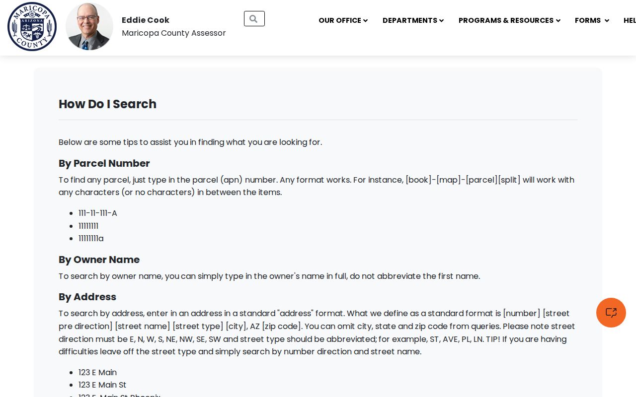
The search options let an El Mirage ZIP code directory move from a broad postal area to one verifiable parcel without claiming that every owner is a resident.
| Field or Mode | Type | Required | El Mirage Use |
|---|---|---|---|
| Main Search | Text/autocomplete | Yes | Accepts city, ZIP, APN, owner, address, subdivision, MCR, STR, or account identifiers |
| City or ZIP Code | Text | No | Returns parcels within the chosen geography |
| Address | Text | No | Number plus abbreviated direction and street type; city, state, and ZIP may be left off |
| Owner Name | Text | No | Use the full first name rather than an abbreviation |
| Subdivision or MCR | Text | No | Finds a development or recorded map number |
The 1,000-Parcel El Mirage Limit
The Parcel Viewer search instructions reveal an unusual strength: “What I Know” includes ZIP Code, and the map also accepts point, line, polygon, circle, extent, and other drawn shapes. A buffer can expand a chosen shape. These tools are useful after a ZIP-level search becomes too broad.
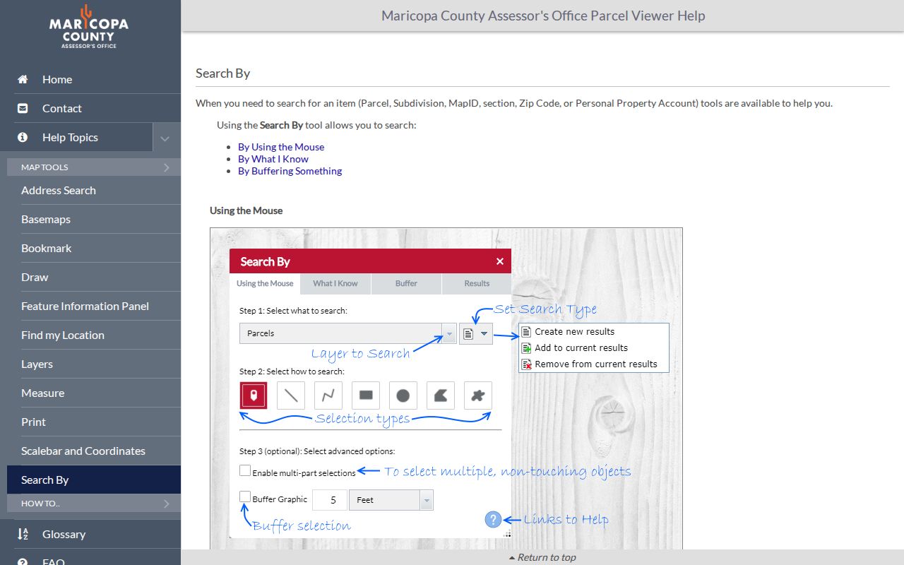
The visible controls show why the map can narrow 85335 to a subdivision or cluster of parcels. Results stop at the first 1,000 selected features, so a ZIP-wide pull may be incomplete. Narrowing is not optional when that cap is reached.
A good sequence is ZIP, subdivision, then a small drawn extent. “Add to current results” can combine careful selections. The result menu can zoom, pan, flash, calculate statistics, or export the chosen features. Parcel boundaries are illustrative, however, and are not a land survey or title report.
Note: A 1,000-feature return is a system ceiling, not a count of El Mirage owners, homes, households, or residents.
Export El Mirage ZIP Parcels
Parcel Viewer can export a selection as a Feature Collection or GeoJSON, a common file format for mapped features. An export may preserve parcel geometry and selected public attributes for research. It does not turn the data into a resident roll. Owner names, when supplied through linked property details, still describe title or tax-mail relationships rather than all occupants.
For family land research or civic study, retain the APN and subdivision MCR. MCR is the county's recorded map reference. Those keys survive many changes that defeat a plain street search. If an old APN was split or combined during El Mirage growth, the Assessor directs researchers to seek a parcel-history report. The report is a better bridge than guessing which current parcel inherited the old number.
Keep the land keys. Save the APN, legal description, and MCR before leaving the Assessor; they link postal geography to the legal parcel.
Postal Edges Around El Mirage
El Mirage sits in the northwest Phoenix metropolitan area near Sun City, Youngtown, Surprise, and Luke Air Force Base. Fast subdivision growth and annexation make perceived neighborhood, postal city, and municipal jurisdiction easy to confuse. The 85335 label may extend through a delivery area without settling a permit or city-record question. Nearby 85351 and 85363 addresses can feel local while belonging to another municipality.
The city's official community overview supplies municipal context for checking the postal result against El Mirage identity.
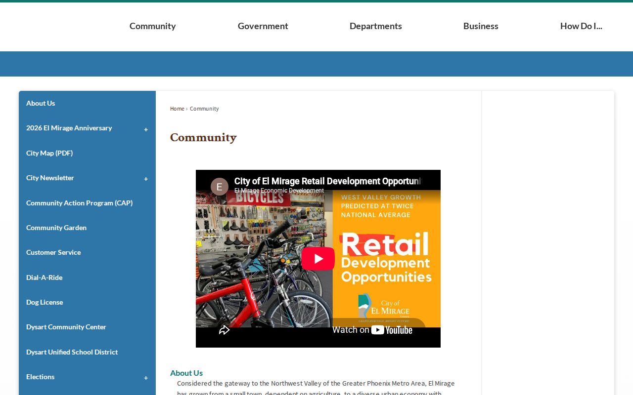
The city source helps distinguish an El Mirage civic connection from a nearby mailing zone. County parcel data still provides the address-by-address answer at the edge.
No official source reviewed documented a wholesale El Mirage street renumbering year. Historic work should compare the recorded plat, parcel history, directory street guide, and annexation map. A postal guide should not invent a realignment or split merely to make the geography sound more complex.
Read El Mirage Address Layers
Four address concepts solve different problems. USPS standardizes delivery. The Assessor's situs address marks physical location. Its owner mailing address tells where tax notice goes, which may differ from the property. The legal description identifies land through subdivision, lot, block, or survey terms even if a street label changes. None should be swapped for another.
- ZIP and ZIP+4
- A ZIP groups a delivery area; the added four digits narrow mail to a smaller segment such as a block, building, or organization.
- PO-box ZIP
- A code reserved for post-office boxes rather than ordinary street delivery. Research does not identify 85335 as PO-box-only.
- Unique ZIP
- A code assigned to one high-volume organization. Research does not identify 85335 as unique.
- Carrier route
- A group of delivery stops assigned to a postal route. It is mail operations geography, not a resident boundary.
The mismatch explains why El Mirage ZIP research needs both postal and parcel checks. Use the physical parcel for ownership and jurisdiction, the mailing form for delivery, and the legal description for older land records.
El Mirage ZIP Resident Limits
A ZIP-wide Assessor result can show owners and tax-mail entries. It omits non-owner occupants and household members. Even a matching situs and mailing address is only support for owner occupancy, not a full household list. A different mailing address may signal an owner receives tax mail elsewhere, but it does not prove why.
Arizona's Voter Information Portal is designed for a voter to retrieve individual registration and election facts with identifying inputs. It is not an anonymous 85335 browser. Broader voter products come from the Maricopa County Recorder through a regulated request. The requester selects geography, fields, format, and a legally permitted use; protected voters are excluded, and ballot choices are never disclosed.
Public voter extracts may include authorized name, public address, party, registration date or status, district, and participation history. Sensitive identifiers and Address Confidentiality Program locations remain withheld. Thus neither the voter channel nor parcel roll supports a complete list of El Mirage residents by ZIP.
Note: Participation history can show whether someone voted in an election, never how that person marked a ballot.
El Mirage ZIP Fallback Channels
When a portal fails, keep the address, APN, subdivision, and date. Ask the Assessor about ownership or mapping, the Treasurer about tax-account facts, and the Recorder about recorded deeds or plats. A parcel-history request can address a split or combined APN. For city permits or address assignment, use a focused El Mirage public-record request after confirming city jurisdiction.
Historical ZIP and address research may need county records, township and range, land descriptions, or neighboring community names. Maricopa County formed in 1871, while El Mirage incorporated in 1951. Early evidence will not always sit under a modern El Mirage heading. Archival records, recorded plats, and directory collections can bridge that gap, but they do not replace current USPS validation.
The best El Mirage ZIP code directory result is therefore a chain: standardized postal address, mapped parcel, jurisdiction check, and only then the record custodian. Each step answers a distinct question. Together they prevent a postal city from becoming an unsupported claim about residence.